


Multibeam Data Processing
Category: Tutorials
- views: 226
- date: 20 March 2026
- posted by: 0nelove
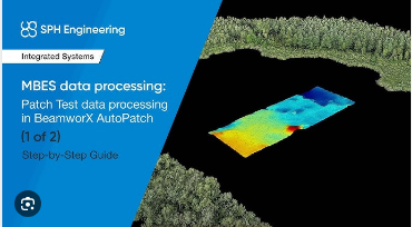
Multibeam Data Processing
Published 3/2026
Created by Matteo Mirabilio
MP4 | Video: h264, 1920x1080 | Audio: AAC, 44.1 KHz, 2 Ch
Level: Intermediate | Genre: eLearning | Language: English | Duration: 13 Lectures ( 3h 50m ) | Size: 3.72 GB
Inside the Multibeam data and Processing -- Using TLR Data for near shoreface to Multibeam data acquired by vessel
What you'll learn
✓ Introduction and review of principal Concept
✓ Integration with Ancillary sensor_frmo GNSS to MetoOcean Data
✓ TLR Data Fundamentals and Coastal Integration
✓ Data Acquisition Challenges and Corrections
✓ Multibeam Data Processing and Quality Control
✓ Interpretation, Applications, and Case Studies
Requirements
● Qgis kwnlodge
● Principal Theory of Acustic Wave
Description
This course provides an in-depth, practical introduction to multibeam echosounder (MBES) data, focusing on how to understand, process, and interpret datasets ranging from near-shoreface environments to deeper waters surveyed from vessels. Participants will explore the full multibeam workflow, with particular emphasis on integrating and using TLR (Topographic–Lidar–Referenced / Topographic–Laser–Referenced, as applicable) data to enhance accuracy, continuity, and interpretation across the coastal to offshore transition zone.
The course begins with the fundamentals of multibeam systems, including acquisition geometry, sensor components, vessel motion, sound velocity, and positioning. Building on this foundation, it examines the specific challenges of nearshore surveys—such as shallow water acoustics, dynamic seabeds, and data gaps—and how TLR data can be used to bridge nearshoreface datasets with vessel-acquired multibeam coverage. Learners will gain hands-on insight into data cleaning, calibration, tidal and motion corrections, surface generation, and quality control.
Emphasis is placed on practical processing strategies, best practices, and common pitfalls when merging datasets from different platforms and resolutions. Case examples demonstrate how integrated multibeam and TLR data support seabed mapping, coastal geomorphology, habitat studies, and engineering or management applications.
By the end of the course, participants will be able to confidently interpret multibeam datasets, apply appropriate processing workflows, and use TLR data to create seamless, high-quality bathymetric products from the nearshoreface to offshore environments.
Who this course is for
■ Marine Geologist
■ Engeneering
https://nitroflare.com/view/60E78AD49084216/Multibeam_Data_Processing.part1.rar
https://nitroflare.com/view/A1D069BAADB3F4B/Multibeam_Data_Processing.part2.rar
https://nitroflare.com/view/681F40D4D02B614/Multibeam_Data_Processing.part3.rar
https://nitroflare.com/view/6712BBC73660DE1/Multibeam_Data_Processing.part4.rar
https://rapidgator.net/file/76ddc9efbbb49c10113cee234836c8a3/Multibeam_Data_Processing.part1.rar.html
https://rapidgator.net/file/f852fc80adabf6f9c74790c2f0d4eba4/Multibeam_Data_Processing.part2.rar.html
https://rapidgator.net/file/d8a837a7f9e1b1b5d4a9a44081d0d057/Multibeam_Data_Processing.part3.rar.html
https://rapidgator.net/file/79051dae59f387a87b96812c9de0bb95/Multibeam_Data_Processing.part4.rar.html
https://nitroflare.com/view/A1D069BAADB3F4B/Multibeam_Data_Processing.part2.rar
https://nitroflare.com/view/681F40D4D02B614/Multibeam_Data_Processing.part3.rar
https://nitroflare.com/view/6712BBC73660DE1/Multibeam_Data_Processing.part4.rar
https://rapidgator.net/file/76ddc9efbbb49c10113cee234836c8a3/Multibeam_Data_Processing.part1.rar.html
https://rapidgator.net/file/f852fc80adabf6f9c74790c2f0d4eba4/Multibeam_Data_Processing.part2.rar.html
https://rapidgator.net/file/d8a837a7f9e1b1b5d4a9a44081d0d057/Multibeam_Data_Processing.part3.rar.html
https://rapidgator.net/file/79051dae59f387a87b96812c9de0bb95/Multibeam_Data_Processing.part4.rar.html
We need your support!
Make a donation to help us stay online

Bitcoin (BTC)
bc1q08g9d22cxkawsjlf8etuek2pc9n2a3hs4cdrld

Bitcoin Cash (BCH)
qqvwexzhvgauxq2apgc4j0ewvcak6hh6lsnzmvtkem

Ethereum (ETH)
0xb55513D2c91A6e3c497621644ec99e206CDaf239

Litecoin (LTC)
ltc1qt6g2trfv9tjs4qj68sqc4uf0ukvc9jpnsyt59u

USDT (ERC20)
0xb55513D2c91A6e3c497621644ec99e206CDaf239

USDT (TRC20)
TYdPNrz7v1P9riWBWZ317oBgJueheGjATm
Information |
|||
 |
Users of GUESTS are not allowed to comment this publication. | ||