


Drought Risk Mapping Using Remote Sensing And Gee
Category: Tutorials
- views: 206
- date: 4 August 2025
- posted by: 0nelove
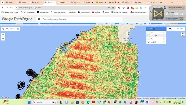
Drought Risk Mapping Using Remote Sensing And Gee
Published 8/2025
MP4 | Video: h264, 1280x720 | Audio: AAC, 44.1 KHz, 2 Ch
Language: English | Duration: 1h 4m | Size: 535 MB
Master the use of satellite remote sensing data and Google Earth Engine to analyze, map, and monitor drought risk
What you'll learn
Analyze drought risk factors using remote sensing data and understand their impact on agriculture.
Process, filter, and visualize multi-source satellite data effectively in Google Earth Engine.
Calculate, normalize, and interpret various drought risk indices using NDVI, rainfall, and soil moisture data.
Develop, export, and utilize detailed drought risk maps to support informed agricultural decision-making and resource management.
Requirements
No prior experience with Google Earth Engine is required — the course will guide you step-by-step.
Description
Drought poses a significant threat to global agriculture, impacting food security, water resources, and livelihoods. This course equips you with cutting-edge skills to analyze and map drought risk using remote sensing data and the Google Earth Engine platform. Beginning with the fundamentals of remote sensing, you'll gain a solid understanding of how satellites like Sentinel-2 capture essential data on vegetation health and soil moisture.The course then delves into remote sensing applications for environmental risk mapping, with a special focus on drought. You will learn to process time-series satellite images, calculate vegetation indices such as NDVI, and assess rainfall and soil moisture anomalies by comparing current data with historical baselines.Next, you will be introduced to Google Earth Engine—a cloud-based platform that simplifies large-scale data analysis. You'll get hands-on experience scripting in GEE to integrate multiple datasets and develop comprehensive drought risk indices. The course also covers normalization techniques and anomaly detection to identify areas of elevated drought risk accurately.In the final modules, you will implement a complete drought risk mapping workflow in GEE. This includes selecting the area of interest, processing seasonal data, combining multiple drought indicators, and visualizing results with effective color palettes. The course culminates with exporting high-quality maps for use in agricultural planning and disaster management.By the end of the course, you will confidently apply remote sensing and GEE tools to support drought monitoring initiatives, helping mitigate the impacts of drought on agriculture and natural resources.
Who this course is for
Students and researchers in agriculture, environmental science, geography, or remote sensing looking to apply satellite data in real-world scenarios
Buy Premium From My Links To Get Resumable Support and Max Speed
https://rapidgator.net/file/ff702958814af274f362c80b89775c30/Drought_Risk_Mapping_Using_Remote_Sensing_and_GEE.rar.html
https://nitroflare.com/view/BD0295C0DBAFC42/Drought_Risk_Mapping_Using_Remote_Sensing_and_GEE.rar
https://rapidgator.net/file/ff702958814af274f362c80b89775c30/Drought_Risk_Mapping_Using_Remote_Sensing_and_GEE.rar.html
https://nitroflare.com/view/BD0295C0DBAFC42/Drought_Risk_Mapping_Using_Remote_Sensing_and_GEE.rar
We need your support!
Make a donation to help us stay online

Bitcoin (BTC)
bc1q08g9d22cxkawsjlf8etuek2pc9n2a3hs4cdrld

Bitcoin Cash (BCH)
qqvwexzhvgauxq2apgc4j0ewvcak6hh6lsnzmvtkem

Ethereum (ETH)
0xb55513D2c91A6e3c497621644ec99e206CDaf239

Litecoin (LTC)
ltc1qt6g2trfv9tjs4qj68sqc4uf0ukvc9jpnsyt59u

USDT (ERC20)
0xb55513D2c91A6e3c497621644ec99e206CDaf239

USDT (TRC20)
TYdPNrz7v1P9riWBWZ317oBgJueheGjATm
Information |
|||
 |
Users of GUESTS are not allowed to comment this publication. | ||