


Drone Data Processing (2024)
Category: Tutorials
- views: 328
- date: 8 April 2024
- posted by: oaxino
Drone Data Processing (2024)
Published 4/2024
MP4 | Video: h264, 1920x1080 | Audio: AAC, 44.1 KHz
Language: English | Size: 3.10 GB | Duration: 2h 34m
Best practise to process drone data
MP4 | Video: h264, 1920x1080 | Audio: AAC, 44.1 KHz
Language: English | Size: 3.10 GB | Duration: 2h 34m
Best practise to process drone data
What you'll learn
Introdution to Drone Surveying Tequique
Cartography and Datum Project
Planning Survey Drone Mission
Download Data and Start Processing
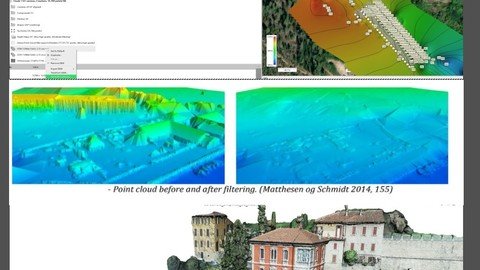
Using Cloud Compare to Filter Point Cloud Drone Survey From Point Cloud to Mesh
Requirements
Gis
Computer Knolodge
Description
The course aims to illustrate the main drone survey techniques; in its first part the main reference systems, datums, coordinates, satellite detection systems, how to carry out coordinate conversion and above all the problems of altimetry when carrying out surveys with the drone will be explained.The acquisition of aerial photogrammetric data does not exclude the use of other techniques such as GPS for ground points.There are various techniques that concern processing, merging photos, calculating the right degree of image overlap, planning detection campaigns based on obstacles present in the area, or on the types of missions, as in the case of park inspections wind and/or solar.It is clear that the methodologies can be influenced by the objectives of the survey. As regards data processing, there are semi-free web applications such as WebDrone - or more advanced systems such as Metashape and CloudCompare. Aerial photogrammetric techniques date back to the early 1900s but today cloud computing techniques have significantly automated and improved them, allowing height and position values to be extracted from individual pixels of the image. These height and position values must subsequently be corrected with the Datum Local. The new points must be specifically filtered to extract only the points of the terrain and other required structures.The final products can be different, from DTM to DSM to density maps, or even Covariance Maps and deviation between the detected points (beaten) and those perceived by the drone.
Overview
Section 1: Introduction
Lecture 1 Introdution to Drone Surveying Tequique
Lecture 2 Cartography and Datum Project
Lecture 3 Planning Survey Drone Mission
Lecture 4 Download Data and Start Processing
Lecture 0 Using Cloud Compare to Filter Point Cloud Drone Survey
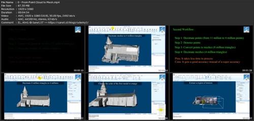
Lecture 0 From Point Cloud to Mesh
Student and Professional
Screenshots
rapidgator.net:
https://rapidgator.net/file/5c634c167c44e27e9215b8ecdd57450c/yhzvb.Drone.Data.Processing.2024.part1.rar.html
https://rapidgator.net/file/e7d8b1898f35a03a0fca19e99ed566ad/yhzvb.Drone.Data.Processing.2024.part2.rar.html
https://rapidgator.net/file/a96be692df70daf076824010f6bf230b/yhzvb.Drone.Data.Processing.2024.part3.rar.html
https://rapidgator.net/file/17df15b1953f5e25730f25f7c4a477ad/yhzvb.Drone.Data.Processing.2024.part4.rar.html
nitroflare.com:
https://nitroflare.com/view/8E092F1E99FFA47/yhzvb.Drone.Data.Processing.2024.part1.rar
https://nitroflare.com/view/185AE0CFFD81BD3/yhzvb.Drone.Data.Processing.2024.part2.rar
https://nitroflare.com/view/1BC4FE855681C37/yhzvb.Drone.Data.Processing.2024.part3.rar
https://nitroflare.com/view/C9B37AE35DC8D6B/yhzvb.Drone.Data.Processing.2024.part4.rar
We need your support!
Make a donation to help us stay online

Bitcoin (BTC)
bc1q08g9d22cxkawsjlf8etuek2pc9n2a3hs4cdrld

Bitcoin Cash (BCH)
qqvwexzhvgauxq2apgc4j0ewvcak6hh6lsnzmvtkem

Ethereum (ETH)
0xb55513D2c91A6e3c497621644ec99e206CDaf239

Litecoin (LTC)
ltc1qt6g2trfv9tjs4qj68sqc4uf0ukvc9jpnsyt59u

USDT (ERC20)
0xb55513D2c91A6e3c497621644ec99e206CDaf239

USDT (TRC20)
TYdPNrz7v1P9riWBWZ317oBgJueheGjATm
Information |
|||
 |
Users of GUESTS are not allowed to comment this publication. | ||