


Open source GIS & remote sensing for conservation (Beginner)
Category: Tutorials
- views: 85
- date: 16 January 2024
- posted by: voska89
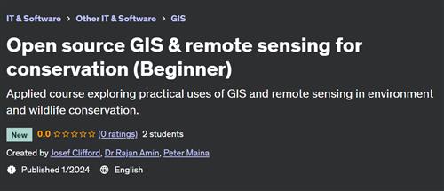
Free Download Open source GIS & remote sensing for conservation (Beginner)
Published 1/2024
Created by Josef Clifford,Dr Rajan Amin,Peter Maina
MP4 | Video: h264, 1280x720 | Audio: AAC, 44.1 KHz, 2 Ch
Genre: eLearning | Language: English | Duration: 60 Lectures ( 5h 59m ) | Size: 4.24 GB
Applied course exploring practical uses of GIS and remote sensing in environment and wildlife conservation.
What you'll learn:
GIS
Remote sensing
Conservation
Environmental issues
QGIS
Ecological surveys
Requirements:
An interest in both conservation and GIS. No previous experience in GIS is required.
Description:
This course introduces essential theoretical concepts of GIS before diving straight into practical uses of this incredible tool to support environment and wildlife conservation. It is suitable for students with limited or no knowledge of GIS, as well as those looking to refresh or enhance their skills applied to the field of conservation. Developed by Josef Clifford, an experienced GIS & remote sensing specialist, the course curriculum and content was developed in collaboration with scientists from the Wildlife Research and Training Institute of Kenya and the Zoological Society of London to ensure the content is rigorous and relevant. Real ecological survey data from Kenya, Cameroon and other locations has also been provided by these institutions which is used within practical sessions of this course. We will cover a multitude of tasks ranging from collecting and managing spatial data during ecological surveys, visualising survey data, and undertaking spatial analysis to understand spatial relationships and extract covariate data. In addition, we will see how to source free spatial data online, how to georeference images, and we will develop publication quality maps. The course will primarily utilise QGIS as well as Google Earth, whilst the advanced course (to be released in late 2024) will also make use of Google Earth Engine and R. Note that the beginner course focuses more on GIS, whilst the advanced course (to be released in late 2024) will explore remote sensing techniques in greater depth. Good luck and I hope you enjoy the course!
Who this course is for:
Conservationists
Ecologists
Wildlife biologists
Conservationists
Beginners in GIS and remote sensing
Professionals in GIS interested in exploring new applications
Homepage
https://www.udemy.com/course/open-source-gis-remote-sensing-for-conservation-beginner/DOWNLOAD LINK
Rapidgator
zwtbw.Open.source.GIS..remote.sensing.for.conservation.Beginner.part1.rar.html
zwtbw.Open.source.GIS..remote.sensing.for.conservation.Beginner.part2.rar.html
zwtbw.Open.source.GIS..remote.sensing.for.conservation.Beginner.part3.rar.html
zwtbw.Open.source.GIS..remote.sensing.for.conservation.Beginner.part4.rar.html
zwtbw.Open.source.GIS..remote.sensing.for.conservation.Beginner.part5.rar.html
Uploadgig
zwtbw.Open.source.GIS..remote.sensing.for.conservation.Beginner.part1.rar
zwtbw.Open.source.GIS..remote.sensing.for.conservation.Beginner.part2.rar
zwtbw.Open.source.GIS..remote.sensing.for.conservation.Beginner.part3.rar
zwtbw.Open.source.GIS..remote.sensing.for.conservation.Beginner.part4.rar
zwtbw.Open.source.GIS..remote.sensing.for.conservation.Beginner.part5.rar
NitroFlare
zwtbw.Open.source.GIS..remote.sensing.for.conservation.Beginner.part1.rar
zwtbw.Open.source.GIS..remote.sensing.for.conservation.Beginner.part2.rar
zwtbw.Open.source.GIS..remote.sensing.for.conservation.Beginner.part3.rar
zwtbw.Open.source.GIS..remote.sensing.for.conservation.Beginner.part4.rar
zwtbw.Open.source.GIS..remote.sensing.for.conservation.Beginner.part5.rar
Fikper
zwtbw.Open.source.GIS..remote.sensing.for.conservation.Beginner.part1.rar.html
zwtbw.Open.source.GIS..remote.sensing.for.conservation.Beginner.part2.rar.html
zwtbw.Open.source.GIS..remote.sensing.for.conservation.Beginner.part3.rar.html
zwtbw.Open.source.GIS..remote.sensing.for.conservation.Beginner.part4.rar.html
zwtbw.Open.source.GIS..remote.sensing.for.conservation.Beginner.part5.rar.html
No Password - Links are Interchangeable
We need your support!
Make a donation to help us stay online

Bitcoin (BTC)
bc1q08g9d22cxkawsjlf8etuek2pc9n2a3hs4cdrld

Bitcoin Cash (BCH)
qqvwexzhvgauxq2apgc4j0ewvcak6hh6lsnzmvtkem

Ethereum (ETH)
0xb55513D2c91A6e3c497621644ec99e206CDaf239

Litecoin (LTC)
ltc1qt6g2trfv9tjs4qj68sqc4uf0ukvc9jpnsyt59u

USDT (ERC20)
0xb55513D2c91A6e3c497621644ec99e206CDaf239

USDT (TRC20)
TYdPNrz7v1P9riWBWZ317oBgJueheGjATm
Information |
|||
 |
Users of GUESTS are not allowed to comment this publication. | ||