


ReefMaster 2.2.57 Portable
Category: Apps (SEO/Marketing/Design)
- views: 418
- date: 19 July 2022
- posted by: voska89
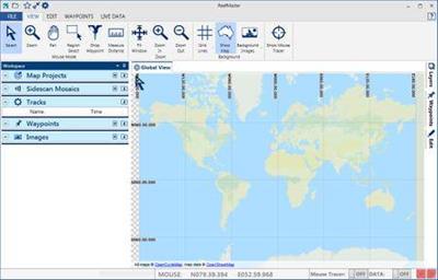
ReefMaster 2.2.57 Portable | 57.7 Mb
With ReefMaster you can create your own maps, view sonar recordings, manage waypoints, and produce stunning high-resolution sidescan mosaic images. ReefMaster is a Windows PC application that uses data from sonar log files to create 3D underwater maps, combined with a multi-channel sonar viewer and graphical waypoint management.
Features
Underwater Mapping
The depth sounder on your boat can detect how deep the water underneath you is. Your GPS knows where you are. ReefMaster puts this depth and position data together to build a highly detailed underwater map.
Create contour maps from sonar log files and view them in 2D and 3D, with a range of base-map options.
Combine mapping data from a wide range of sources, including native Lowrance and Humminbird sonar logs, GPX files, NMEA 0183, ESRI Shapefiles and text files.
Create maps of the sea or lake bed hardness using the optional Bottom Composition add-on module.
Calculate water volumes using the optional Volumes and Areas add-on module.
Create, drag and drop waypoints in both the 2D and 3D map views.
View and export maps in a range of pre-defined palettes, or create your own colour scheme.
Adjustable contour intervals in metric or US units.
Create maps up to 400kmВІ in size.
Create maps in real-time with NMEA 0183 data:
Log depth and position data via NMEA 0183.
Create maps in real time, with a split screen (live-track/map) display.
Receive GPS and depth from up to two separate NMEA sources, with adjustable latency.
Show the live boat position on any ReefMaster screen.
Save your maps in a range of formats, including:
Single click export for a range of Lowrance and Google Earth Preset Map Styles.
Generate stunning AT5 vector or shaded-relief maps for Lowrance and Simrad GPS units.
Create contour maps as track files for display on Humminbird devices.
Export full-colour contour maps in Google Earth's KML format for display within Google Earth and mobile devices.
Save geo-referenced, high-resolution map images for use in documents and websites.
Save contour maps in ESRI Shapefile format and 3D bathymetry in ESRI grid format for use in other GIS applications.
Multi-channel Sonar Viewer
Compatible with Humminbird and Lowrance sonar log files.
Multi-channel, split-screen display with smooth playback up to 30x.
Adjustable brightness, contrast and colour palettes.
Create waypoints in the sonar viewer.
Measure distance and estimate object height or depth using shadow length.
Adjust track-point depths in the sonar viewer to correct bottom-lock errors.
Waypoint Management
View and edit waypoints, with drag and drop in 2D and 3D.
Import and export waypoints in a range of formats, including native Lowrance, Humminbird and GPX, with automatic duplicate elimination.
Support for multiple waypoint sets, with easy, graphical copying and moving of waypoints across sets.
Attach any number of notes and images to waypoints.
Track Management
Store your past tracks in ReefMaster, with easy access via the Asset Library.
View tracks over world base-maps.
Crop, split and merge tracks, and save the results back to your GPS unit.
Adjust track-point depths for lake-level or tide variations.
Log data from NMEA data sources.
Export raw track data in a range of formats, including comma-separated text files for use in other GIS applications.
System Requirements:
1GB RAM (4 GB recommended, 8GB and 64 bit OS recommended when running the Sidescan Mosaic module or creating maps larger than 15km across).
850MB free disk space.
Windows 7/8/8.1/10
Hardware graphics support for Microsoft DirectX 10.1 or later is required for some sonar and sidescan rendering features. These features will be disabled if this hardware support is not available.
Home Page-
https://reefmaster.com.au/DOWNLOAD LINK
https://www.uploadcloud.pro/g3i1w0wt72w0/w23ql.ReefMaster.2.2.57.Portable.rar.html

https://rapidgator.net/file/a3e609dd576980a683827678baa2fea3/w23ql.ReefMaster.2.2.57.Portable.rar.html

https://nitro.download/view/DF21807623D2273/w23ql.ReefMaster.2.2.57.Portable.rar

https://uploadgig.com/file/download/51d036018a7EE9c0/w23ql.ReefMaster.2.2.57.Portable.rar
We need your support!
Make a donation to help us stay online

Bitcoin (BTC)
bc1q08g9d22cxkawsjlf8etuek2pc9n2a3hs4cdrld

Bitcoin Cash (BCH)
qqvwexzhvgauxq2apgc4j0ewvcak6hh6lsnzmvtkem

Ethereum (ETH)
0xb55513D2c91A6e3c497621644ec99e206CDaf239

Litecoin (LTC)
ltc1qt6g2trfv9tjs4qj68sqc4uf0ukvc9jpnsyt59u

USDT (ERC20)
0xb55513D2c91A6e3c497621644ec99e206CDaf239

USDT (TRC20)
TYdPNrz7v1P9riWBWZ317oBgJueheGjATm
Information |
|||
 |
Users of GUESTS are not allowed to comment this publication. | ||