Project - Ship Detection From Satellite Imagery Using Ml
Date: 8 April 2024 | Posted by: AD-TEAM
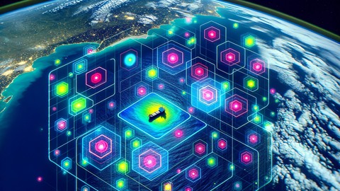
Project - Ship Detection From Satellite Imagery Using Ml
Published 4/2024
MP4 | Video: h264, 1920x1080 | Audio: AAC, 44.1 KHz
Language: English
| Size: 1023.26 MB[/center]
| Duration: 2h 46m
Learn Image Processing and Machine Learning Through Resume Worthy Certified Project
What you'll learn
Identify and classify ships in satellite images using machine learning techniques.
Apply image processing methods to enhance satellite imagery for analysis.
Implement machine learning models specifically tailored for spatial data recognition.
Execute a complete project workflow, from data acquisition to model evaluation.
Requirements
Python Programming Basic Knowledge is Required
Description
Embark on a transformative journey into the world of satellite imagery analysis with our comprehensive Udemy course, "Project - Ships Detection Using Satellite Imagery". Designed for enthusiasts and professionals alike, this course demystifies the process of using cutting-edge machine learning techniques to identify and classify ships in satellite images. Whether you're aiming to bolster your skills in computer vision, eager to dive into spatial data analysis, or looking to apply machine learning in new and exciting ways, this course provides the knowledge and hands-on experience you need.Final Curriculum Overview:Module 1 - Introduction and Data Exploration: Start with the basics of the project, exploring the dataset, understanding the applications of machine learning in computer vision, and setting up your development environment.Module 2 - Run Length Encoding and Decoding: Dive into the specifics of Run Length Encoding (RLE), a critical technique for handling and interpreting satellite image data efficiently. Learn how to work with RLE encodings to create segmented masks for images.Module 3 - Data Preparation and Preprocessing: Master the art of preparing and preprocessing your data, covering everything from data augmentation to setting up parameters for model building and training.Module 4 - Image Segmentation using UNET: Delve into image segmentation with a focus on UNET, a powerful convolutional neural network architecture. Understand its components, build your own UNET model, and train it to detect ships in satellite imagery effectively.Why Choose This Course?Hands-on Learning: Engage with practical exercises and real-world dataset to solidify your understanding and skills.Expert Instruction: Learn from an instructor with real-world experience in machine learning and computer vision.Future-Proof Skills: Gain knowledge that's in demand in industries ranging from maritime navigation to environmental monitoring.Start your journey towards becoming proficient in satellite imagery analysis with machine learning today. Whether you're enhancing your skillset or pioneering new solutions, this course equips you with the knowledge and tools you need to succeed.Visit spartificial[dot]com for DISCOUNTS
Overview
Section 1: Project Introduction and Data Exploration
Lecture 1 Introduction
Lecture 2 Module Intro
Lecture 3 Dataset and Aim of the Project
Lecture 4 Some Applications of Machine Learning in Computer Vision
Lecture 5 Importing Libraries for the Project
Lecture 6 Exploring the Dataset
Lecture 7 Module Outro
Section 2: Run Length Encoding and Decoding
Lecture 8 Module Intro
Lecture 9 Run Length Encoding and Decoding
Lecture 10 Explore the RLE encodings for our Dataset
Lecture 11 Create a segmented mask from RLE encodings
Lecture 12 Create a Function that can convert given RLE encodings to Mask
Lecture 13 Module Outro
Section 3: Data Preparation and Preprocessing
Lecture 14 Module Intro
Lecture 15 Initiating Train and Validation Data Preparation
Lecture 16 Random Undersampling for Ships in the Dataset
Lecture 17 Setting up Parameters for Model Building and Training
Lecture 18 Build the Training and Validation Dataset
Lecture 19 Data Augmentation for Images and Masks
Lecture 20 Garbage Collection
Lecture 21 Module Outro
Section 4: Image Segmentation using UNET
Lecture 22 Module Intro
Lecture 23 Overall Idea of UNET and CNNs
Lecture 24 Convolutions and Pooling Layers in CNN
Lecture 25 But why UNET and these layers?
Lecture 26 Understand and Build UNET
Lecture 27 Compile the Model (combo loss solution)
Lecture 28 Prepare Callbacks
Lecture 29 Model Training and Saving weights
Lecture 30 Module Outro
Lecture 31 Project Conclusion
Whoever interested in Satellite and Aerial image and data science

https://voltupload.com/h5p9yww6elj1/Project_-_Ship_Detection_from_Satellite_Imagery_using_ML.z01
https://voltupload.com/k4c4tanvwyl3/Project_-_Ship_Detection_from_Satellite_Imagery_using_ML.zip
https://rapidgator.net/file/aced21494b5abd2f2e0c4aaebdc3e326/Project_-_Ship_Detection_from_Satellite_Imagery_using_ML.z01
https://rapidgator.net/file/a6c6e6f27a4fbc1644fd4ef0ac7597fb/Project_-_Ship_Detection_from_Satellite_Imagery_using_ML.zip
Free search engine download: Project - Ship Detection from Satellite Imagery using ML
See full article